How cameras save lives: DJI FlightHub 2 gives a bird's eye view for search & rescue
Lives can be saved when technology is put to good use – here's how DJI's FlightHub 2 empowers search & rescue missions

The best camera deals, reviews, product advice, and unmissable photography news, direct to your inbox!
You are now subscribed
Your newsletter sign-up was successful
Technology has played a massive role in revolutionizing our world as we know it, and DJI has been leading the way in the enterprise industry.
With the launch of its new Matrice family, the DJI M30 / M30T annouced at the DJI Enterprise event, a new feature comes to the enterprise sector that can help first responders, firefighters, police officers and other agencies help protect the public and save lives.
• Check out the best DJI drones
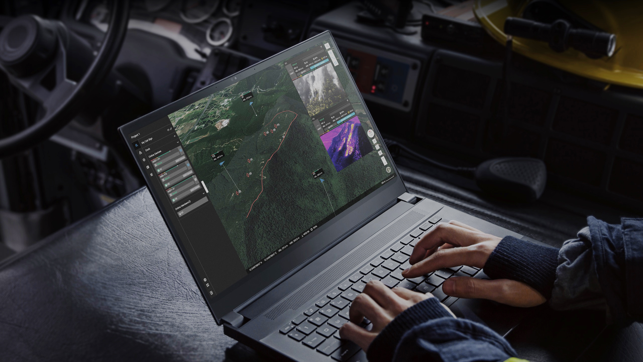
This new tech comes in the form of a highly sophisticated software called DJI FilghtHub 2. This enterprise fleet management software benefits from major improvements over its first version, synchronizing and coordinating between ground teams at work, drones, payloads, pilots and all the data they gather.
The DJI FlightHub 2 is now entirely cloud-based, which enables flight mission management and operational viewing not only from the pilot’s RC, but from any device with a web browser – such as computers, tablets, and even mobile devices.
So everyone on the team can be involved in a drone operation, from ground teams to nearby supervisors to managers in their offices; all can log into the same mission and see the data gathered by the drones and the pilots, making this an extremely useful tool in any situation or environment.
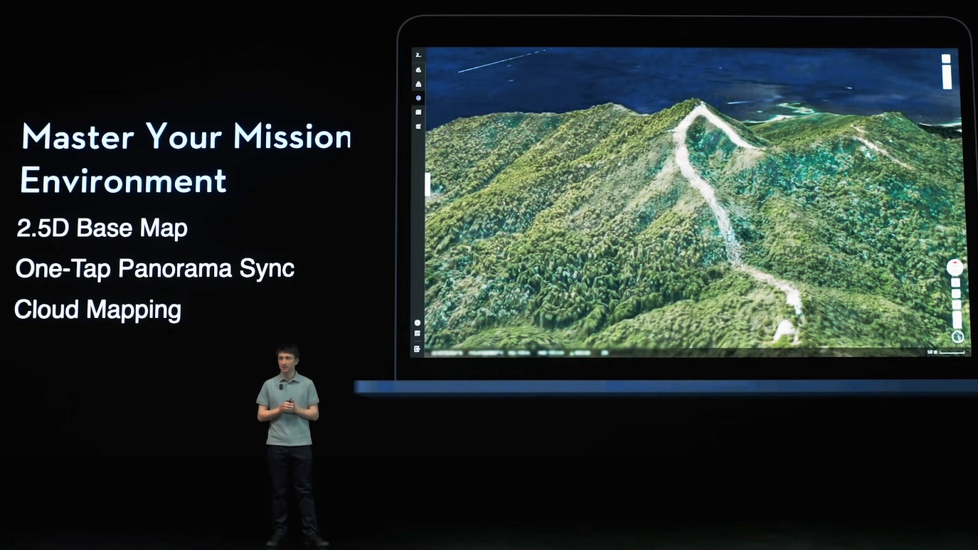
DJI FlightHub 2 also supports amazing mapping features, enabling users to respond quickly to developing situations. Its base 2.5D mapping takes a satellite map of your search area and overlays elevation data onto it, giving you a visual representation of the environment around you and how you might want to fly the drone for best search coverage.
The best camera deals, reviews, product advice, and unmissable photography news, direct to your inbox!

Once the drone is in the air you can take advantage of a new feature called One-Tap Panorama Sync, which creates a 360 panorama of a dedicated search area and marks it on the map for quick and easy navigation – and avoiding covering the same area twice. This 360 panorama is then shared to all synced devices over the cloud network, so the drone pilot can continue surveying the areas while teams on the ground can begin the search in real time.
But it doesn't stop there; if you need high-resolution detail of your surroundings as they appear on the scene, DJI has developed Cloud Mapping – a protocol that makes your M30 take high-quality satellite imagery of your search area within minutes of your request, and then overlays your 2.5D imagery giving the best search control and management of an area 0.9 miles² / 1.5 km² to date. This is when technology really is an amazing thing and can be used for so much good in the world, it is just outstanding.
FlightHub 2 also supports live annotations, which are points, lines or polygons that users can draw on the map. Thanks to the laser rangefinder of the DJI M30, in a search and rescue mission a pilot can pinpoint the coordinates of a missing person.
These coordinates will automatically sync through the DJI FlightHub 2 mission interface, enabling the command center and the team on the ground to have live updates of coordinates and to simultaneously generate rescue routes. All these maps, models and inspection data can be uploaded to the cloud, supported by AWS, and accessed and managed remotely.
This is absolutely mind-blowing that technology and software can do so much, in such little time to help save lives or prevent catastrophic outcomes with drones. What a time to be alive – and to help people stay that way.
Read more:
Best DJI drones
Best camera drones
Best FPV drones
Best drones for photography

For nearly two decades Sebastian's work has been published internationally. Originally specializing in Equestrianism, his visuals have been used by the leading names in the equestrian industry such as The Fédération Equestre Internationale (FEI), The Jockey Club, Horse & Hound, and many more for various advertising campaigns, books, and pre/post-event highlights.
He is a Fellow of the Royal Society of Arts, holds a Foundation Degree in Equitation Science, and holds a Master of Arts in Publishing. He is a member of Nikon NPS and has been a Nikon user since his film days using a Nikon F5. He saw the digital transition with Nikon's D series cameras and is still, to this day, the youngest member to be elected into BEWA, the British Equestrian Writers' Association.
He is familiar with and shows great interest in 35mm, medium, and large-format photography, using products by Leica, Phase One, Hasselblad, Alpa, and Sinar. Sebastian has also used many cinema cameras from Sony, RED, ARRI, and everything in between. He now spends his spare time using his trusted Leica M-E or Leica M2, shooting Street/Documentary photography as he sees it, usually in Black and White.
